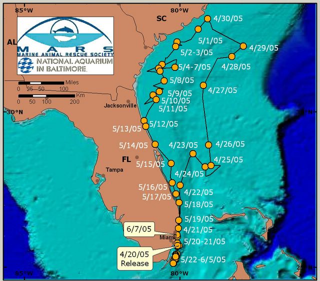
WORD OF CAUTION: We post the above map since that is what was used throughout our monitoring period. As one can see, it appears as though Notch is on the beach (perhaps getting good seats for the Air and Sea Show!), however, the above map and dots are not to scale, therefore, it should only be used to demonstrate an overall trend in position, and not an actual position. The nautical chart posted below, while difficult to read for some, provides a true position at the time of data collection.
Here is the final tracking map and National Weather Service information showing where the Gulf Stream was located throughout the week. Notch and Naia are definitely still staying out far enough to be found in the Gulf Stream.
GULF STREAM HAZARDS...SEAS UP TO 8 FEET TONIGHT THROUGH SATURDAY.
THE APPROXIMATE LOCATION OF THE WEST WALL OF THE GULF STREAM AS OF
JUN 10, 2005 AT 1200 UTC...
2 NAUTICAL MILES EAST OF FOWEY ROCKS.
8 NAUTICAL MILES EAST OF PORT EVERGLADES.
6 NAUTICAL MILES SOUTH OF LAKE WORTH.
THIS DATA COURTESY OF THE NAVAL OCEANOGRAPHIC OFFICE.
posted by Hadjez Family at 6/10/2005 03:50:00 PM
2 comments
![]()

